 |
 |
 |

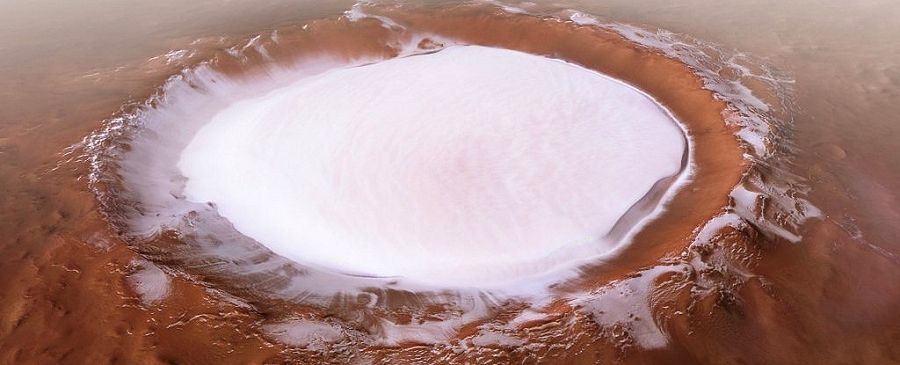
AMAZING IMAGE ICE DUNES ON MARS |
|
This photo was captured by the spacecraft and shared by NASA on its website. According to the US space agency, “a field of sand dunes occupies this frosted crater 5 kilometers in diameter in the high latitudes of the plains north of Mars. Some dunes have separated from the main field and seem to climb the slope of the crater along a kind of ravine ”. Indeed, a study published last year revealed that the planet Mars would have been covered with glaciers and not rivers. Breathtaking Martian icy dunes The image of the Orbiter probe is totally captivating. Thanks to its high definition, it allows us to see the different textures at the bottom of the crater. NASA effectively explained that the striped and lobed patterns "indicate seasonal thaw caused by sublimation of ice." The Mars Reconnaissance Orbiter took this image in February 2021. It used its camera called “High Resolution Imaging Experiment” or HiRiSE. It was then about 315 kilometers above sea level from the red planet. The Orbiter probe also managed to capture an image of the Perseverance rover landing on Mars on February 18. |
|
| Alyson Braxton for DayNewsWorld | |
 |
|